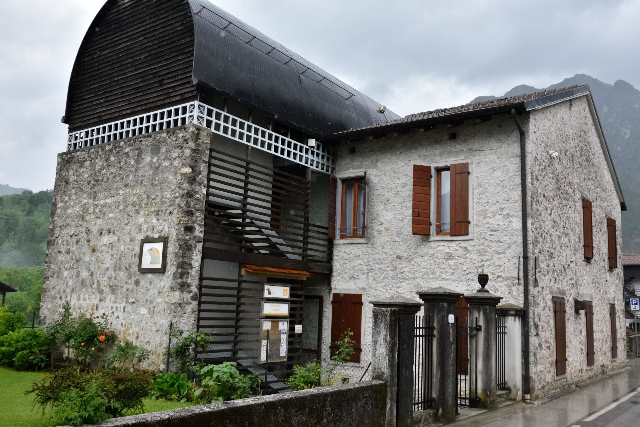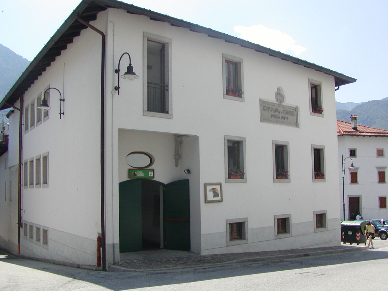

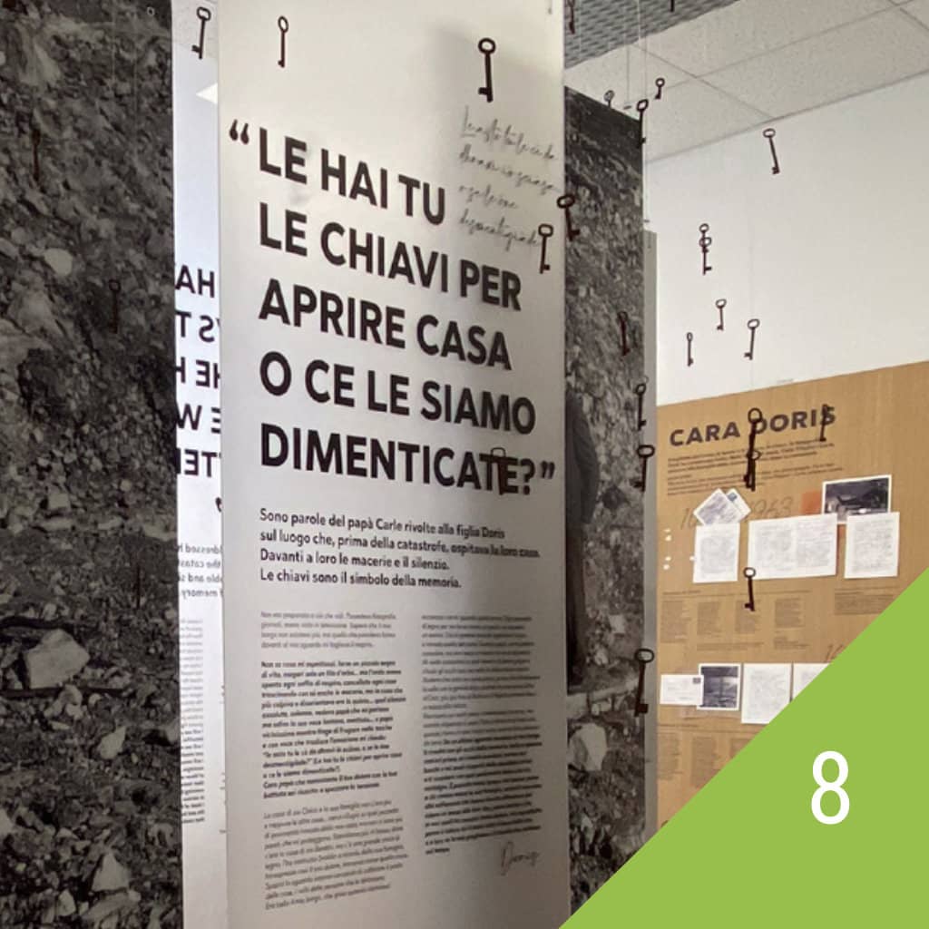
A space for memory
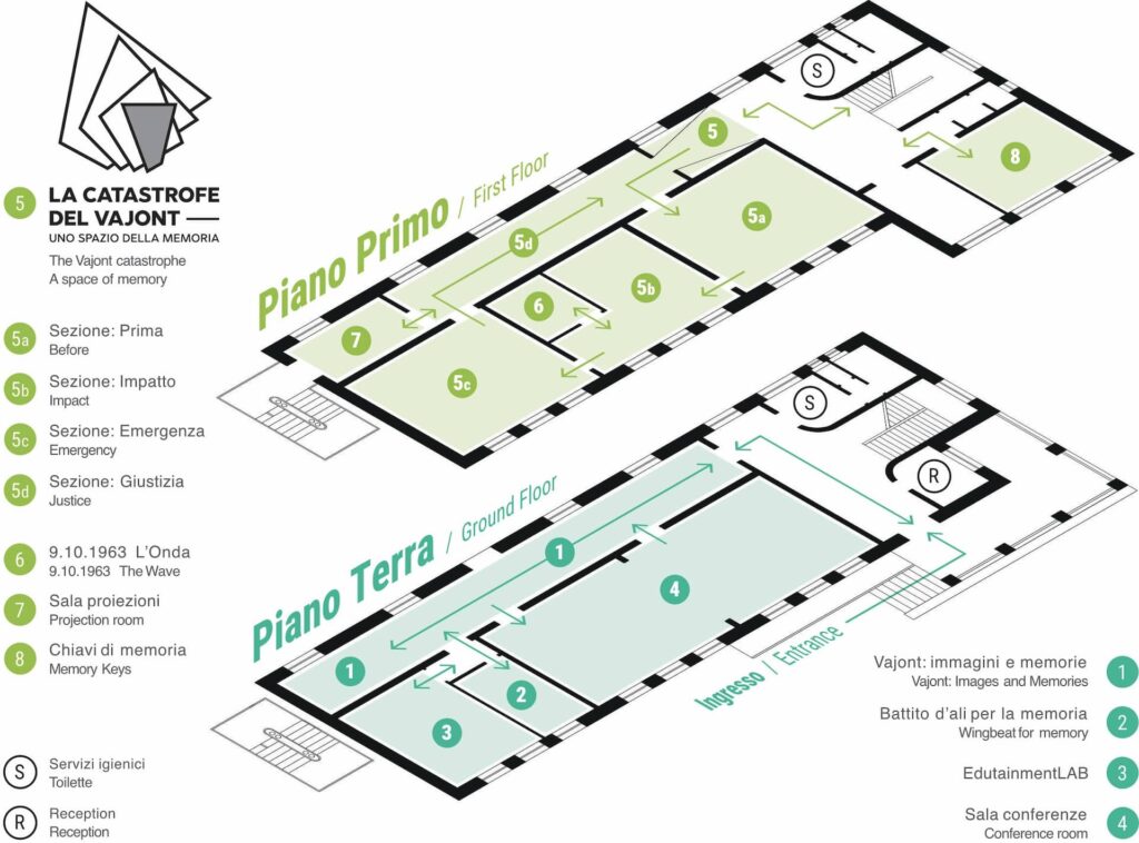
The Visitors Center of the Park offers visitors a memory of the catastrophe of October 9, 1963. 9 ottobre 1963.
The natural environment of the valley was upset and the community suffered:
- death and ruin;
- poor management of the risk level, both “before” with an excess of optimism and “after” with an excess of prudence;
- poor management of the emergency and reconstruction.
For decades the community was expelled from the valley, deprived of its economy and pushed up to the split of its original unity. A third of a century has passed, but justice has run its course just a few years ago.
FIRST SECTION OF THE EXHIBITION
“BEFORE THE IMPACT”
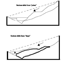
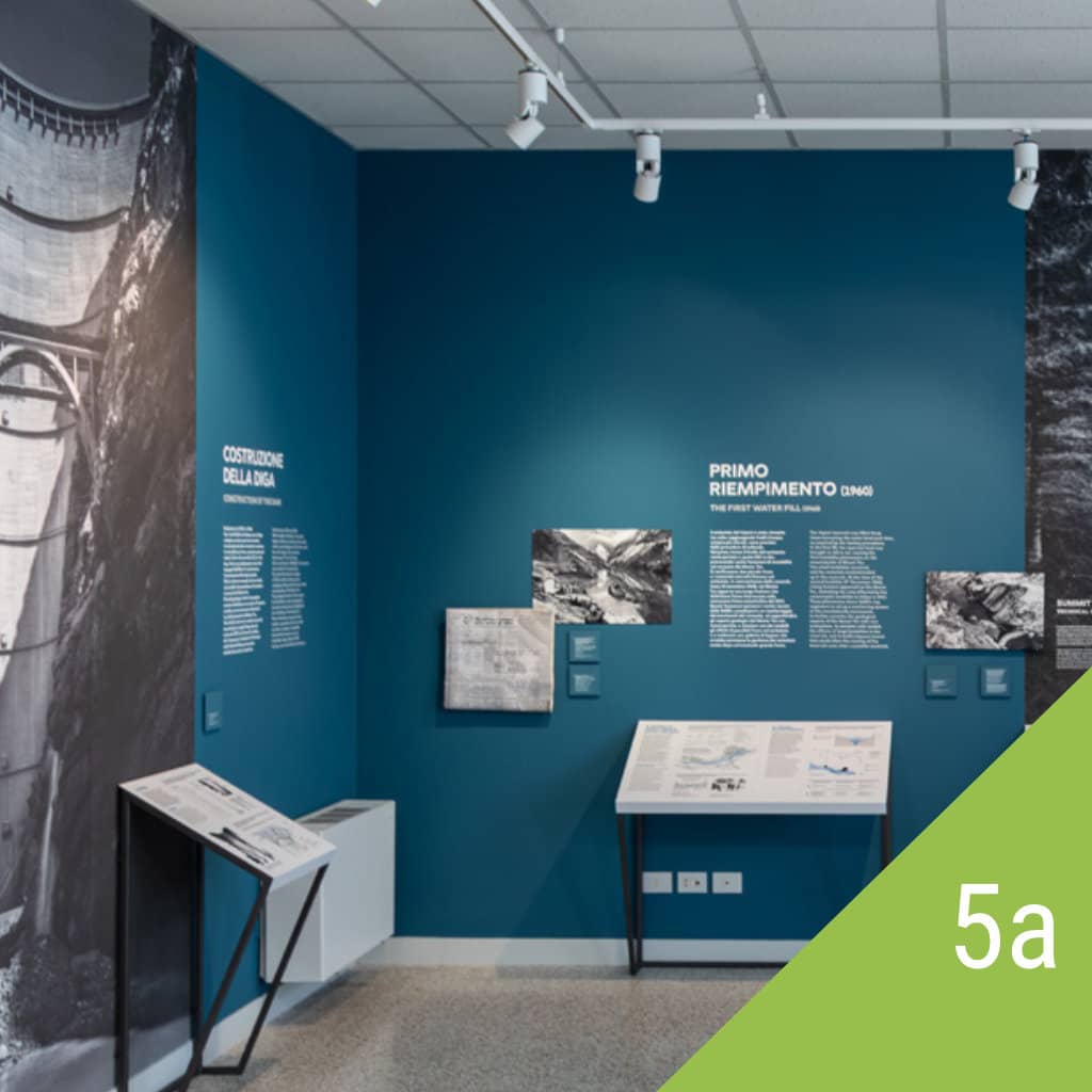
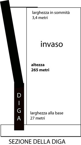
In the late ’50s, the community was deeply bound to a traditional agricultural economy, integrated with a small street trading. The narrow gorge of Vajont suggests to SADE the idea of using the valley as a reservoir. It is thus realized a double curved dam of 265 meters, the highest in the world at the time. In 1960, coinciding with the start of the reservoir, two landslides took place. It is arranged a monitoring of the unstable slope, an extension of two million square meters. So it is settled an accurate diagram of the relationships between the increase of the lake level and the rise of the landslide movements.
In October 1963 the imminence of the landslide is obvious. There are not taken adequate measures to protect the population.
SECOND SECTION
” THE IMPACT”
On the 9th of October 1963 a landslide of 300 million cubic meters collapses downstream within a time frame of 40 seconds, with a speed of 65km / h. The impact of the landslide in the lake moves a mass of 48 million m³ of water:
- with a wave of 80 meters which spreads in the lake, devastating the settlements of the banks;
- with a wave of 170 meters that crosses the dam and, rushing to the valley from a height of 400 meters, destroys the underlying villages.
THIRD SECTION
“EMERGENCY AND RECONSTRUCTION”
After the landslide there is no more control of the lake level. In the bleak scenery of the shocked valley, “after” the disaster, institutions overestimate the risk. The entire population is evacuated.
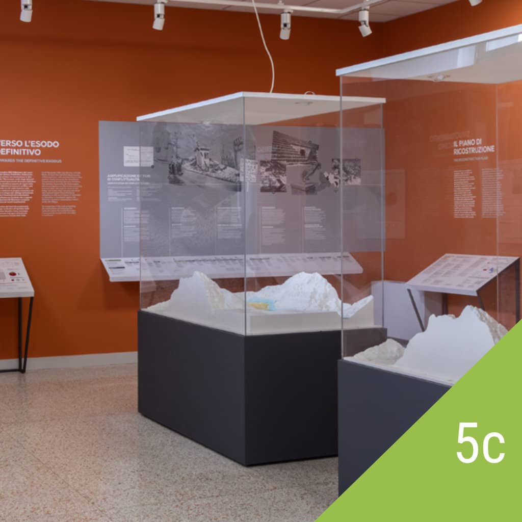
When, three years later, the lake has been completely emptied, the institutions insisted on forcing the inhabitants to leave their villages. This ended up in a strong internal conflict between those who accepted the relocation and those who wanted to regain their valley and live there. In 1971 took place the traumatic split of the community through the establishment of the new village of Vajont.
The Reconstruction Plan extends its action on an area 22 times larger than the damaged one and almost “forgets” the Vajont valley. Except for the restoration of viability on the right bank, the only intervention plan consists in the abandonment of the old part of Erto, to build a new settlement nearby. No other intervention has been implemented in the valley. The whole left side of the valley is still burdened by inaccessibility constraints never removed.
FOURTH PART
“JUSTICE”
Criminal case
The criminal case has been lasting over 8 years:
- are committed for trial 11 defendants;
- in the first trial, the prosecutor required a sentence of 158 years in total;
- the judge in the retrial states that “the landslide does not exist from a legal point of view …” and sentenced, for the mere failure alarm, 3 defendants, for a total of 12 years;
- on appeal the sentence, for the mere failure alarm, of 3 defendants, for a total of 12 years;
- on appeal the sentence was reduced to a total of four years and six months;
- Supreme Court of Appeal expanded the responsibility and reduced the sentence for two defendants for a total of 2 years and 8 months
Civil case
Filed against the ENEL company by the municipalities of Erto and Casso and then by that of Vajont. In 2000, 37 years after the catastrophe, the final ruling obliged ENEL to pay damages in the amount of 6,109,685 Euros.
October 9, 1963
ANNA DE LORENZI’S STATEMENT (CASSO)
That evening, I put to sleep Renata and Fausto and then I went to Magareta who lived in front of me, to observe from the terrace the mount Toc illuminated by a beacon light located near the Vajont dam. It was after 10.30 PM.
Suddenly, we saw the pine and larch trees that moved with the ground below. Immediately after the beacon light went out and I heard an indescribable noise, which I had never heard before and Magareta told me: – It is the end of the world. So we took shelter near the wall of the house, because the stones were falling from all sides and water was wetting us. I looked at the sky and it was clear, there were also the stars. Then we retreated into the house. After moments of bewilderment I said I was going to see my children who were alone. I went out on the porch and then I found myself on the way I had to cross to go to my house. There was water all around and I could not move. Still I had to shelter under the porch and wait a few minutes because the water ceased. Then I went into the house in a hurry.
I found Renata desperate because the bedroom window was open and the water had entered, wetting everything. Renata said, “Where were you, I called and you did not answer me, the light does not come on and we are all wet.” I lit the candle, I prepared the kids and we all went to my mother’s house. There was desperation because my sister Giacomina and my brother Dino were missing. I took my children and Gervasia to my mother’s bed and then I went down to the kitchen. Soon came Luciano, my nephew, who had already returned from “Fraséign” in the company of other men, where he had been looking for his mother. He was desperate, crying and saying: “How will we do without my mom? We are three brothers and Gervasia is still young. ” Meanwhile, also arrived Pasca,the grandmother and hearing this consoled them and slapping her chest repeated: “I am here, I will take care of you all, do not worry, I will do everything.” And Luciano replied: “Grandma, you’re old, and my mom is gone. What will we do now that our mother is dead? In Fraséign there are no more huts, no stables, there are no roads, there’s nothing left! ”
I looked at him and I realized he was all muddy, from hair to toe. He had deformed shoes for walking in the dark, in the mud, because there was no trace of the road. My mother said: “Who knows if my Dino is still in the village or if he has already gone to the construction yard.” She still had a glimmer of hope, later she found out that he had already left so deeply distressed at hearing this news she closed in upon herself and spoke no more. More people arrived at home, my mother did not want to see anyone, she just wanted to be left alone, because she was thinking about her sons, about Dino who had not yet turned 24 and Giacomina that had left three children alone. Meanwhile, Gervasia, from the bedroom, kept calling me and beg me to send her to her mother. She insisted on her mom and I did not know what to tell her, because her mother was dead. I lied by saying: “She will come tomorrow.” It was a terrible night that I would not remember, it grabs my heart; I have a knot in my throat and I can not hold back the tears.
THE LANDSLIDE OF MOUNT TOC AND THE VAJONT VALLEY
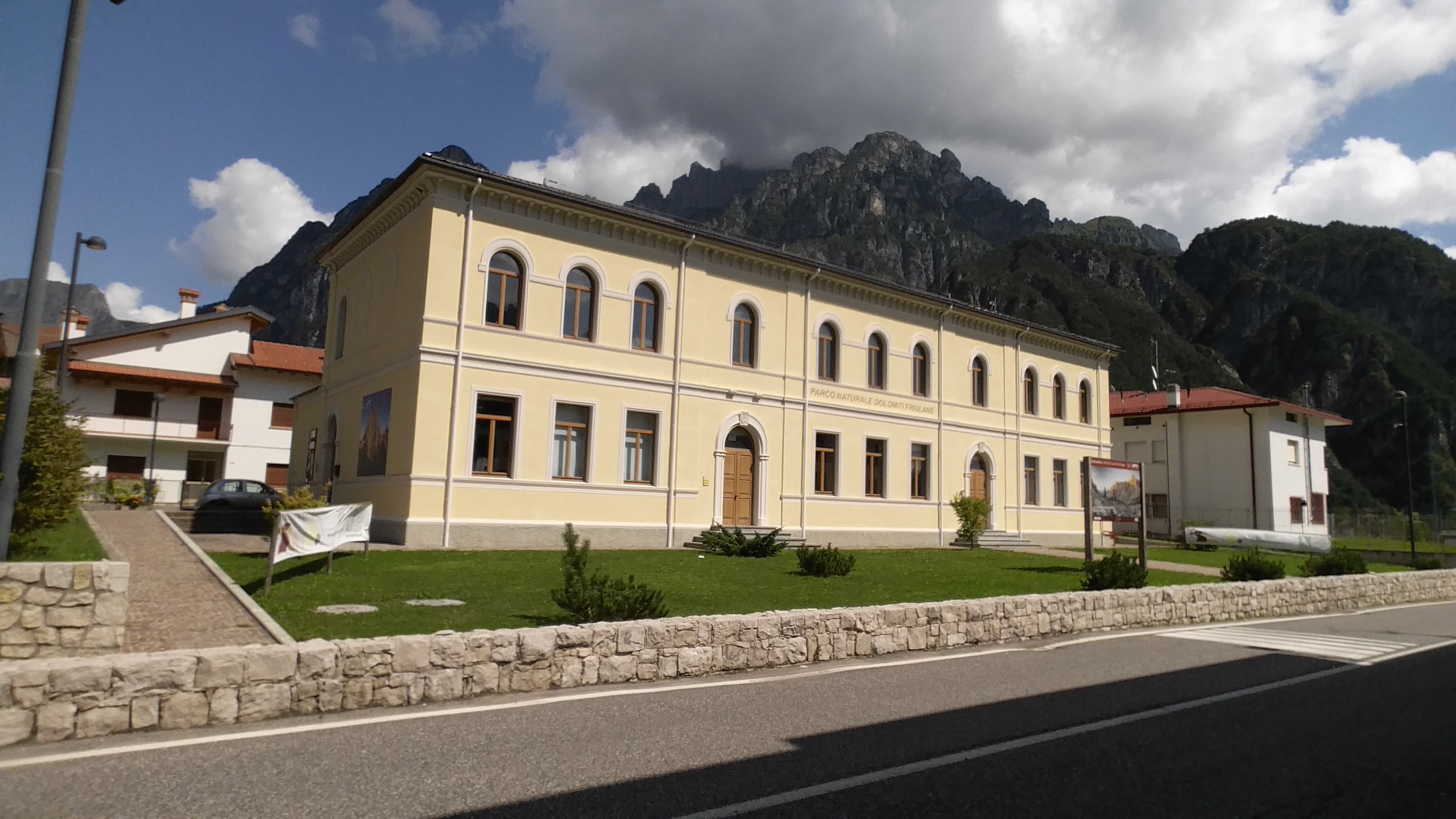
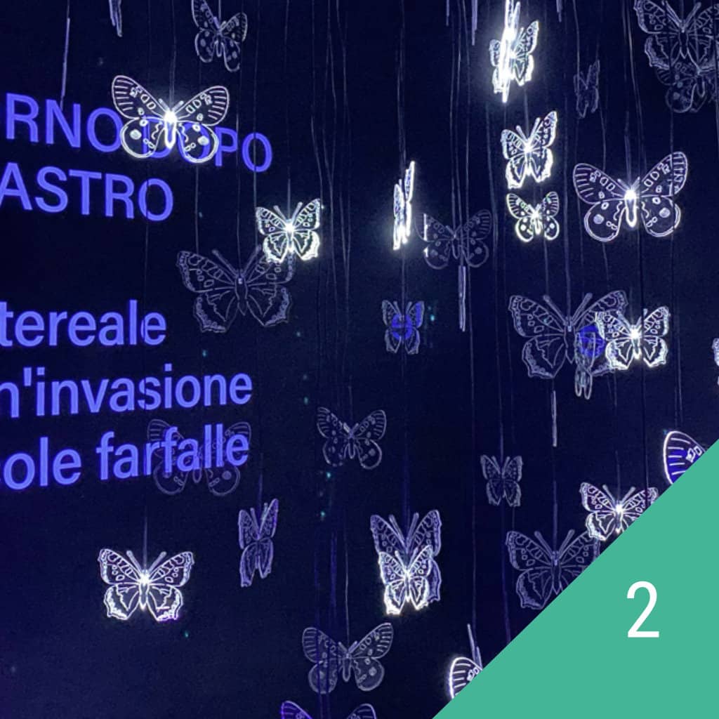
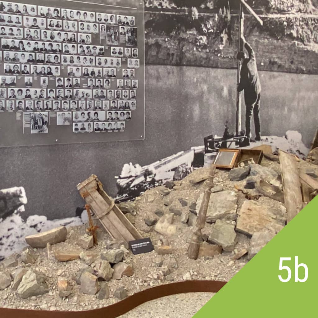
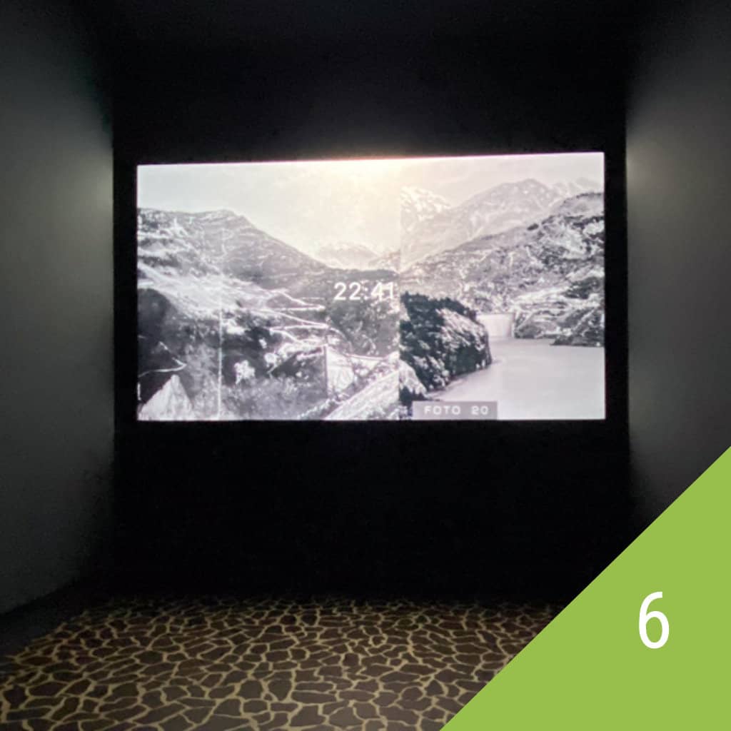
The Vajont Landslide, which detached from the northern slopes of Mount Toc on October 9, 1963 at 10:39 PM, has caused serious and different consequences that, after many years, have been only partially remedied in part thanks to the work of man and partly also due to the spontaneous course of nature. The huge mountain portion, detached and collapsed suddenly in the basin below, shocked and dramatically changed the landscape itself; the giant wave, high fifty meters and possibly more, banging randomly along the banks of the lake and diverted by the rock ridges destroyed the villages of Fraseign, Spesse, Pineda, Prada, Marzana and S. Martino, removing the solid squared stone buildings up to their foundations. The village of technicians and workers built in the immediate vicinity of the dam, consisting of offices, houses, a canteen, various services including a couple of shops, was destroyed and buried by the collapsed mountain. All this with a result of over two hundred dead of whom only 17 were found. The remains of the workers’ village are still visible and can be visited along an easy path which begins near the Vajont dam: the “Trui de la Moliesa”. The wave on its way eroded forests and cultivated land, destroyed every human work such as roads, bridges, technological equipment, etc. For many months on the lake, which continued to dangerously rise threatening the village survivors, floated, covering it, every type of rubble, timber and household goods, together with the remains of decaying animals. To prevent that the lake flooded the village of Erto and overflown over the top of the landslide, it was necessary to pump water over the Pass S. Osvaldo through large water pumps making it flow into the stream Cellina. This unnatural flow lasted for a few years, until it was restored the bottom tunnel (by-pass) submerged and partly damaged by the landslide; so it was possible to restore the water flow into the Piave valley and empty the left lake. The emptying of the lake, from a point of view prevented the danger, but left bare the banks of the valley and the valley floor, which looked lunar and shocking due to erosion, to the total lack of vegetation and mud from the bottom. The consequences and effects of these events, especially for that part of the surviving population of Erto who stubbornly and courageously fought and chose to continue living in the valley, have never been properly assessed and considered. Only after the play by Marco Paolini, carried around in squares and broadcast on television and the making of the movie “Vajont” by Renzo Martinelli public opinion, but also ordinary people, are more aware and concerned about this issue. The most obvious impact is still and always will be the change of the landscape and the devastation also geographical and morphological of the places; where there was a deep valley now there is a mountain, where there was a large lake remains an eroded and rough valley, in place of meadows and inhabited huts of the Toc there is a huge white stone slab. With the passing of years the weather and nature have remedied in part the collapse, in fact, the waters have reshaped its moving riverbeds rebuilding part of the water network, the pioneer vegetation gradually resettled making green the hillsides and slopes, where humus and substrate permit it, were born several species of shrubs and trees and even wildlife has taken possession of the territory. The Park of the Friulian Dolomites decided to include in its territory the landslide area since it is considered a geological phenomenon unique in the world. The visitors center of Erto houses a photographic exhibition on the Vajont catastrophe “A space for memory”, where it is described in a precise and scientific way the whole thing that struck the people of Erto, Casso and Longarone. In addition to the descriptive panels you can see charts, graphs, comparing 3-D models and a CD-ROM that allows you to have a global vision on the disaster and observe the graphic reconstruction of the landslide also with original footage. All this makes the Visitors Center of Erto an important and complete documentation center on the tragic event and also a valid point of reference for studies and research.
The Vajont Stream Valley connects the wide valley of the River Piave with the Friuli plain through Val Cellina. It is a narrow valley, characterized by steep and precipitous slopes; on both the right bank and the left bank of the river, there are the villages of Erto and Casso and the hamlets of Le Spesse, S. Martino, Prada, Liron, Pineda. At the end of the fifties and the beginning of sixties, a few hundred meters upstream of the confluence with the River Piave, the stream Vajont was blocked, with hydroelectric purposes, by a dam. This plant was never officially operative because a huge landslide partially filled the tank causing a huge wave and nearly 2,000 victims.
GEOLOGY AND GEOMORPHOLOGY
The Vajont landslide is the latest and most tragic chapter in the long and complex history of the life of a mountain, during which rocks were formed, they were raised and then eroded; in this story you can also find some of the causes that have provoke the landslide.
The formation of rocks
165 million years ago, the area of Mount Toc and that of the Vajont valley were part of an underwater slope extended that served as a link between a shallow sea area and a deep sea one ( 700-1000 m). Due to frequent landslides the materials became homogeneous limestone rock formations, then thin layers of limestone alternated repeatedly with levels of clay and carbonate mud. The landslide of Mount Toc involved precisely the thick and uneven alternation of limestone and clay; the latter, moreover, during the movement of the landslide have acted as a lubricant material facilitating the sliding.
Il sollevamento delle rocce
About 30 million years ago the limestone rock formations and alternations of limestones and clays were folded, fractured and subsequently lifted, due to the events that gave rise to the Alps. The detachment area thus coincided precisely with the slope that goes up from the valley to the Mount Toc’s peak.
L’erosione delle rocce
Over the past two million years, the weather and the action of the glaciers shaped the slopes of the Vajont valley. More substantial changes to the morphology of the valley were impressed by man and nature, between 1957 and 1963: meadows, gorges and cultivation present on the steep slopes of the valley were buried by the artificial lake, under about 150 million meters cubes of water; then the landslide of Mount Toc turned into a hill what previously used to be a part of the valley.
THE LANDSLIDE
The landslide that detached from the northern slopes of Mount Toc had huge dimensions: with a front of more than two kilometers, a width of at least 500 meters and a height of about 250, it transported downstream over 270 million m3 of rocks and debris. This mass, if it were removed by 100 trucks, would decrease of 1 mm per day: at such pace, it would take 7 centuries to remove it all! The landslide had, in addition to the enormous size, even a high speed: advancing at about 100 km / h, this was the acceleration that, within few seconds, climbed up the opposite side for more than a hundred meters, barring the valley and changing it permanently. At the time of the disaster, the height of water in the vicinity of the dam was equal to 240 m and the tank contained little more than a third of the total of the reservoir. The impact force of the landslide mass created two waves that went one toward the mountain, wiping away out the villages along the shores of the lake and the other toward the valley. The latter overcame the artificial barrier rising above it until it reached the lower houses of the village of Casso, located 240 m above the dam; then it was channeled into the narrow gorge of the Vajont, gaining more and more speed and energy;at the exit of the gorge, the mass of water, 70 meters high and with a speed of about 96 km / hour, poured into the Piave valley razing to the ground the village of Longarone and some nearby villages. The victims of this tragic disaster, which occurred in less than 5 minutes, were 1909.
THE DAM
Already at the beginning of the century some private companies had realized the possibility of a widespread exploitation of the waters of the River Piave as a basin to produce electricity. Between the 30s and 60s were formulated and gradually perfected various projects leading to the creation of a series of dams, reservoirs and hydroelectric stations in more places along the course of the River Piave and its main tributaries. It also started the construction of a complex and great network of forced ducts that, by connecting the various reservoirs, allowed to exploit the same water several times. In this logic of rational and widespread use of the Piave basin, the Vajont dam took on a key role: indeed it received the waters from all the tanks located in the upper valley of the River Piave, which were then conveyed into the artificial lake Val Gallina, cargo tank above the Soverzene hydroelectric station. Just in relation to its important role the Vajont dam was redesigned and enlarged, becoming the “Grand Vajont” project. In 1957, the Venetian company SADE introduced the final project and started the work that was completed in 1959. The dam, an arched building 264.6 m high, was the largest of its kind and the second ever in the world. Since 1960 began the dam testing with the filling of the reservoir. Already from the first reservoir was clear the general instability of the lake and above all of the left bank: the slope was indeed affected by signs of movements such as tilted trees, cracks in the ground and cracks on the houses’ walls; on November 4th , 1960 a landslide detached from the mount and slid into the lake while, at the top, appeared a long fracture in the form of M, which caused then the the landslide detachment of the 9th of October 1963. Some engineers formulated two hypotheses depending on the type of movement : the first one predicted a subsequent landslide of medium size, the other a single, large sliding; but no one expected the speed and violence with which the event occurred.
ARC DAM
- HEIGHT: 264,6 m
- MAXIMUM AMOUNT OF THE RESERVOIR: 722,5 m asl
- MINIMUM AMOUNT OF THE RESERVOIR: 462 asl
- MAXIMUM RESERVOIR: 725,5 m asl
- TOTAL RESERVOIR: 168.715.000 m³
- PROFIT RESERVOIR : 150 million m³
BIBLIOGRAFIA SUL VAJONT
AJEMIAN R., “There the dam stood, proud and beautiful”, Life Magazine. Vol. 55, n. 12, pp. 30-41, 1963.
APRILIS N., DRI G. (a cura di), “Monografia sul Vajont (1963-2023)”, Rassegna Tecnica del Friuli Venezia Giulia & Notiziario Ingegneri, anno LXIX, settembre/dicembre 2023.
BOYER R. A., “Etude géologique des environs de Longarone (Alpes Vénitiennes)”,
Bull. Soc. Géol. France, Paris. S. 4, vol. 13, pp. 451-485, plus geologic map (1:50.000), 1913.
BOZZI C., MERLA G., TREVISAN L., SELLI R., VIPARELLI M., “Commissione di inchiesta sulla sciagura del Vajont. Relazione al Ministro dei Lavori Pubblici”, Bozzi Commission Report, 108 pp., 1964.
BROILI L., “New knowledge on the geomorphology of the Vajont slide slip surface”, Rock Mechanics and Rock Engineering, 1, 38-88, 1967.
CALOI P., “L’evento del Vajont nei suoi aspetti geodinamici”, Annali di geofisica, XIX, 1, 1966.
CALVINO F., “Elementi tecnici di prevedibilità della catastrofe del Vajont”, Sapere, Ed. Dedalo, n.768, pp. 8-15. Roma, 1974.
CAMILLO PAVAN EDITORE (a cura di), “Dighe e centrali idroelettriche del Bacino del Piave - Elenco completo degli impianti con i dati tecnici al 1963. Ristampa di pubblicazioni ufficiali della SADE, Società Adriatica di Elettricità”, Camillo Pavan Ed., Treviso 2001.
CANESTRINI S., “Vajont: genocidio di poveri”, Cultura Ed., Firenze 1969.
Carloni G.C., “Il Vajont trent’anni dopo. Esperienza di un geologo”, Cleub Bologna, 1995.
CARLONI G.C., MAZZANTI R., “Aspetti geomorfologici della frana del Vajont (Geomorphological aspect of the Vajont Slide)”, Rivista Geografica Italiana, Firenze. vol. 71, n. 3, pp. 201-231, 1964.
CARLONI G.C., MAZZANTI R., “Rilevamento geologico della frana del Vajont”, pp. 105-138. In: “La frana del Vajont”. Annali del Museo Geologico di Bologna. ser. 2, vol. 32, 1964.
CIABATTI M., “La dinamica della frana del Vajont”, pp. 139-154, In: “La frana del Vajont”. Annali del Museo geologico di Bologna, ser. 2, vol. 32, 1964.
DAL PIAZ G., “Relazione di massima su due sezioni della valle del Vajont prese in considerazione per progetti di sbarramento idraulico”, 4 pp., relazione inedita SADE, 1928.
DAL PIAZ G., “Sulla struttura geologica della valle del Vajont agli effetti degli smottamenti dei fianchi che possono derivare dal progettato invaso e dalle oscillazioni del livello del lago”, 9 pp., relazione inedita SADE, 1948.
DAL PIAZ G., “Relazione geologica sul tracciato della strada perimetrale sulla sinistra del serbatoio del Vajont”, 4 pp. 1 tav., relazione inedita SADE, 1958.
DAL PIAZ G., “Esame delle condizioni geologiche del bacino del Vajont e della zona di imposta della diga di sbarramento quale risultano allo stato attuale dei lavori (9 luglio 1960)”, 21 pp. 12 tavv., relazione inedita SADE, 1960.
Datei C., “Vajont. La storia idraulica”, Libreria internazionale Cortina, Padova, 2005.
ENEL - Commissione per la verifica dello stato di efficienza e sicurezza dei grandi bacini idroelettrici dell'ente. “Relazione sulle cause che hanno determinato la frana nel serbatoio del Vajont (9 ottobre 1963)”, Roma 1964.
FRATTINI M., ARREDI F., BONI A., FASSO C., SCARSELLA F., “Relazione sulle cause che hanno determinato la frana nel serbatoio del Vajont (9 ottobre 1963)”, Frattini Commission Report prepared for ENEL, 92 pp., 1964.
GAMBAROTTO S., “Vajont 9 ottobre 1963 - Cronologia di una morte annunciata”, Editrice Storica Treviso, 2013.
GENEVOIS R., GHIROTTI M., “The 1963 Vajont landslide”, Giornale di Geologia Applicata, 1, 41-52, 2005.
GERVASONI A., “Il Vajont e le responsabilità dei manager”, Bramante Ed., Milano 1969.
GHETTI A., “Esame su modello degli effetti di un’eventuale frana nel lago-serbatoio del Vajont (SADE Venezia)”, Istituto di Idraulica e Costruzioni Idrauliche dell’Università di Padova, Ricerca n. 10, 1962.
GHIROTTI M., “Modellazione numerica della frana del Vaiont sulla base di nuovi dati”, Geologica Romana, 30, 208-216, 1994.
GIUDICI F., SEMENZA E., “Studio geologico del serbatoio del Vajont”, unpublished report. Part A, text, 21 pp. Part B, photographs, 68 with discussions, 42 pp. and 2 maps and sections prepared in 1959 (1:5000), 1960.
HENDRON A.J., PATTON F.D., “The Vajont Slide, a Geotechnical Analysis Based on New Geologic Observations of the Failure Surface”, Technical Report GL- 85-5, U.S. Army Engineer Waterways Experiment Station, Vicksburg, MS. I,II, 1985.
KIERSCH G.A., “Vajont reservoir disaster”, Civil Engineering. Amer. Soc. Civil Engrs. March, pp. 32-39, 1964.
LEGGE 4 NOVEMBRE 1963 N.1457, “Provvidenze a favore delle zone devastate dalla catastrofe del Vajont del 9 ottobre 1963”, in G.U. n. 292/09.11.1963.
LEGGE 31 MAGGIO 1964 N. 357, “Modifiche ed integrazioni della legge 4 novembre 1963, n. 1457, recante Provvidenze a favore delle zone devastate dalla catastrofe del Vajont del 9 ottobre 1963”, 1964.
MARTINELLI FOZZA O., “Il mio Vayont”, Comune di Vajont, 1976.
MARTINIS B., “Stratigrafia della valle del Vajont”, relazione inedita AGIP, 30 pp., 1964.
MARTINIS B., “Contributo alla stratigrafia dei dintorni di Erto-Casso (Pordenone) e dalla conoscenza delle caratteristiche strutturali e meccaniche della frana del Vajont”, Memorie di Scienze Geologiche, Università di Padova, 32, 1-33, 1978.
MASE’ G., SEMENZA M., SEMENZA P., SEMENZA P., TURRINI M.C. (a cura di), “Le foto della frana del Vajont”, Album “S2. Fotografie della zona del Toc e dintorni (Vajont) prese dal luglio 1960 all’aprile 1961”, agosto 1965, © K-Flash 2004.
MASETTI D., “Stratigrafia delle formazioni pre quaternarie affioranti nella valle del Vajont e nei gruppi montuosi adiacenti”, Atti del convegno Frana del Vajont, Ferrara, 1986.
MERLA G., VIPARELLI M., “Studio dell'onda di piena seguita alla frana del Vajont”, Allegato alla Relazione della Commissione di inchiesta sulla sciagura del Vajont, 12 pp., 2 tavv., Relazione ciclostilata a cura del Ministero dei LL.PP., Roma 1964.
MERLIN T., “Sulla pelle viva. Come si costruisce una catastrofe. Il caso Vajont”, La Pietra Edizioni, Milano 1983.
MORETTI A., VALDINUCCI A., “Relazione sulla frana del bacino del Vajont”, Serv. Geol. It., Relazione inedita, Roma 1963.
MÜLLER L., “La frana della zona del Toc”. Diga del Vajont 15° rapporto geologico preparato per conto della SADE. Relazione inedita, 1961.
MÜLLER L., “Discussion of Differences in the Characteristic Features of Rocks and Mountain Masses”, Proc. 5th Int. Conf. of Int. Bur. Rock Mechanics, Leipzig, Germany, 1963.
MÜLLER L., “The rock slide in the Vajont Valley”, Rock Mechanics and Engr. Geol. Jour. Int. Soc. Rock Mechanics, vol. 2, pp. 148-212, 1964.
MÜLLER L., “Relazione geomeccanica sulla frana di roccia del 9 ottobre 1963”, ltalian translation by ENEL-SADE of Müller's report of 2/9/64, 89 pp., 1964.
MÜLLER L., “New considerations on the Vajont Slide”, Rock Mech. Eng. Geol., 6 (1-2), 1-91, 1968.
MÜLLER L., “The Vajont catastrophe - A personal review”, Engineering Geology, 24 (1-4), 423-444, 1978.
MÜLLER L., “The Vajont Slide”, Engineering Geology, 24 (1-4), 513-523, 1987.
P.C.I. (a cura del), “Libro bianco sulla catastrofe del Vajont”, Roma, 1963.
PAOLINI M., VACIS G., “Il racconto del Vajont”, Garzanti Ed., 1997.
PASSI M., “Morire sul Vajont. Storia di una tragedia italiana”, Marsilio Ed., Padova 1968.
PROCURA DELLA REPUBBLICA DI BELLUNO, “Requisitoria. Procedimento penale contro gli imputati del disastro del Vajont”, P. M. Arcangelo Mandarino, 22 nov. 1967, Belluno 1967.
Pittarello B., “Vajont ottobre 1963”, Cierre Ed., nuova edizione, Verona 2013.
Reberschak M., “Il grande Vajont”, Cierre Ed., nuova edizione aggiornata, Verona 2016.
RIVA M., BESIO M., MASETTI D., ROCCATI F., SAPIGNI M., SEMENZA E., “La geologia delle valli Vajont e Gallina (Dolomiti orientali)”, Annali dell’Università di Ferrara, Sezione Scienze della Terra, 2 (4), 55-76, 1990.
RIVIS L., “La storia idraulica del Grande Vajont - rievocata da un addetto ai lavori che allora c'era”, Momenti AICS, 2a edizione, 2012.
ROSSI D., SEMENZA E., “Relazione definitiva sulle condizioni di stabilità della Costa delle Ortiche (Vajont)”, unpublished, 18 pp., 11 photos, geologic map and sections (1:5.000), and stratigraphic columns, 1964.
ROSSI D., SEMENZA E., “Carte geologiche del versante settentrionale del M. Toc e zone limitrofe, prima e dopo il fenomeno di scivolamento del 9 ottobre 1963, scala 1:5000”, Istituto di Geologia, Università di Ferrara, 2 Maps, 1965.
Sacchet A., “Vajont. La diga”, Associazione Pro Loco di Longarone, 3a edizione aggiornata, 2008.
Selli R. - Trevisan L., “Caratteri e interpretazione della frana del Vajont”, pp. 07-104. In: “La frana del Vajont”. Annali del Museo Geologico di Bologna. ser. 2, vol. 32, 1964.
SEMENZA C., “La diga del Vajont”, in: "L'industria italiana del cemento", pp. 602-608 a. XXXI, n. 12, 1961.
SEMENZA C., “Impianto idroelettrico Piave-Boite-Maè-Vajont. Criteri generali della progettazione e dell'esecuzione”, in: "Scritti di Carlo Semenza", Venezia, 1962.
SEMENZA C., “Le utilizzazioni idroelettriche ed irrigue nel bacino del Piave”, in: "Scritti di Carlo Semenza", Venezia, 1962.
SEMENZA C., “L'industria italiana del cemento”, in: "Scritti di Carlo Semenza", Venezia, 1962.
SEMENZA E., “Nuovi studi tettonici sulla valle del Vajont e zone limitrofe”, Rend. Acc. Naz. Lincei, Roma. Cl. Sc. Fis. Mat. Nat. vol. 28, Fas. 2, pp. 223-229, 2 tavv., 1960.
Semenza E., “Sintesi degli Studi Geologici Sulla Frana Del Vajont”, Museo Tridentino di Scienze Naturali, Trento, 1966.
Semenza E., “La storia del Vajont. Raccontata dal geologo che ha scoperto la frana”, Tecomproject, Padova, 2001.
SEMENZA E., GHIROTTI M., “Vajont-Longarone 34 anni dopo la catastrofe”, Annali dell’Università di Ferrara (Nuova Serie), Sezione Scienze della Terra, 7 (4), 63-94, 1998.
SEMENZA E., GHIROTTI M., “History of 1963 Vaiont slide. The importance of the geological factors to recognize the ancient landslide”, Bulletin of Engineering and the Environment, 59, 87-97, 2000.
SEMENZA E., MELIDORO G. “Atti del convegno sulla Frana del Vajont del 1963”, Ferrara, Cansiglio e Vajont, 17-19 settembre 1986, Ferrara 1992.
SESSO G., “Vajont. Immagini del Toc Prima e Dopo”, Campanotto Ed., Pasian di Prato 2008.
SOCIETA’ FILOLOGICA FRIULANA, “Li animutis del Vajont”, in: Racconti Popolari Friulani (zona di Montereale Valcellina), 1978.
SUPERCHI L., FLORIS M., GHIROTTI M., GENEVOIS R., JABOYEDOFF M., STEAD D., “Implementation of a geodatabase of published and unpublished data on the catastrophic Vajont landslide”, Natural Hazards and Earth System Sciences, 10, 865-873, 2010.
SUPERCHI L., WOLTER A., STEAD D., CLAGUE J.J., GHIROTTI M., GENEVOIS R., “Comparison of photogrammetric and field survey data from the sliding surface of the 1963 Vajont Slide, Italy”, Geophisical Reserch Abstract, 13, 2011.
SUPERCHI L, ZORZI L., FERRI,F., GENEVOIS,R., IAFELICE M., “Geomechanical evaluation of the rock mass involved in the 1963 Vajont landslide (NE Italy)”, The Second Word Landslide Forum, Rome, Italy, 3-9 october, 2011.
VALDINUCCI A., “Bacino del Vajont. Sulle variazioni di livello del lago residuo”, Serv. Geol. It., Relazione inedita, Roma 1964.
VALDINUCCI A., “Sulle condizioni di stabilità dell’abitato di Casso (provincia di Udine)”, Serv. Geol. It., Relazione inedita, Roma 1964.
VALDINUCCI A., “Sulle condizioni di stabilità delle pendici a monte di Erto (provincia di Udine)”, Serv. Geol. It., Relazione inedita, Roma 1967.
VALDINUCCI A., “Aree edificabili situate nelle immediate adiacenze dell’ abitato di Erto (provincia di Pordenone)”, Nota suppletiva alla Relazione del 5.10.1967. Serv. Geol. It., Relazione inedita, Roma 1968.
VALDINUCCI A., “Sulla natura dei terreni ove si stanno eseguendo i lavori per il nuovo insediamento di Erto (provincia di Pordenone)”, Serv. Geol. It., Relazione inedita, Roma 1971.
VALDINUCCI A., “Comune di Erto e Casso (provincia di Pordenone). Ampliamento dell’area scelta per la ricostruzione dell’abitato di Erto”, Serv. Geol. It., Relazione inedita, Roma 1972.
VASTANO L., “Vajont l’Onda lunga. 1963-2003. Quarant’anni di tragedie e scandali”, Sinbad Press, 2006.
WOLTER A., SUPERCHI L., STEAD D., CLAGUE J., GENEVOIS R., GHIROTTI M., “Preliminary results of a photogrammetric characterization of the 1963 Vajont Rockslide”. In Geohazards 5th Canadian Conference on Geotechnique and Natural Hazards, Kelowna, B.C., Canada, 9, 2011.
ZANFRON G., “Vajont, 9 ottobre 1963 - cronaca di una catastrofe”, Agenzia fotografica Zanfron, ed. ottobre 1998.
ZANOLLI R., “Vajont. Cronaca di una tragedia annunciata”, Dario De Bastiani Ed., Vittorio Veneto 2013.
Articoli
L’Unità, “La SADE spadroneggia ma i montanari si difendono”.
Martedì 5 maggio 1959, Pagina 4.
Articolo di Tina Merlin.
Associazione culturale Tina Merlin - Belluno
Il Gazzettino - Edizione straordinaria, “Disastro alla diga del Vajont”.
Giovedì 10 ottobre 1963, Prima pagina.
Messaggero Veneto, “Una delle più spaventose tragedie nella storia del nostro Paese. Nella sciagura del Vajont i morti sono più di 2500”.
Venerdì 11 ottobre 1963, Prima pagina.
Corriere della Sera, “Le vittime sarebbero duemiladuecento. L’onda della morte”.
Venerdì 11 ottobre 1963, Prima pagina.
Corriere della Sera, “Coraggio, seppelliamoli, non c’è altro da fare. Tutto è irrimediabilmente finito”.
Venerdì 11 ottobre 1963, pagina 3.
Il Gazzettino, “L’immane disastro del Vajont. Scomparsa ogni traccia di vita a Longarone e nei paesi vicini”.
Venerdì 11 ottobre 1963, Prima pagina.
La Stampa, “Sotto le acque della diga, nell’alto corso del Piave, tremila morti nella fiumana”.
Venerdì 11 ottobre 1963, Prima pagina.
L’Unità, “Oggi sarà presentato al presidente Sini il Libro bianco sulla tragedia del Vajont.
Atto di accusa”.
Domenica 13 ottobre 1963, Prima pagina.
L’Unità, “La tragedia del Vajont. La montagna scesa nel lago”.
Lunedì 14 ottobre 1963, pagina 3.
L’Unità, “Aveva scritto a chiare lettere tutta la verità - Non fu un colpo giornalistico:
Tutti sapevano nessuno si mosse”.
Domenica 13 ottobre 1963, pagina 7.
Siti
Progetto Dighe – il punto di riferimento per gli appassionati di dighe, centrali idroelettriche e opere idrauliche. www.progettodighe.it